Zheng He Voyage Map: All Seven Voyages on One Chart
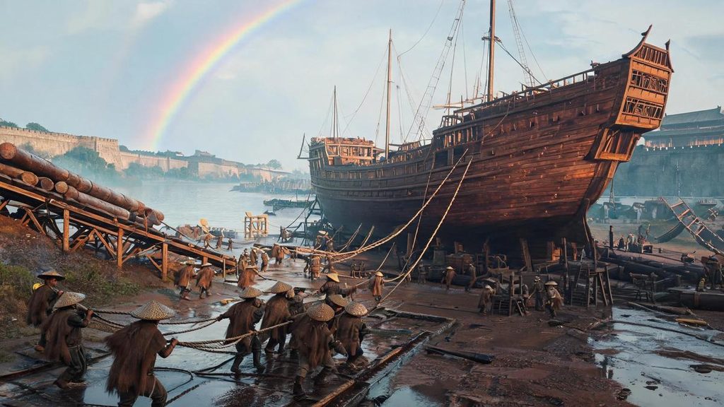
The Zheng He voyage map starts at a shipyard. The Treasure Shipyard in Nanjing is where the Ming built their oceangoing ships, the Yangtze, reaching open sea only after Longjiang, the river gate. For what that yard actually built, see our guide to Ming treasure ships. A Ming hand began the chart at that shipyard, drew the Yangtze, then the coast, then west until it stopped at Hormuz, in the Persian Gulf. The chart carries no title of its own, only a line of explanation at the start.
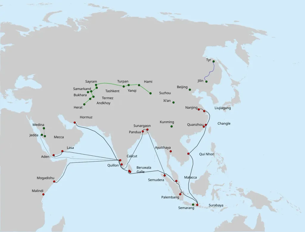
This Zheng He voyage map also serves as a single-page reference for all seven Ming treasure-fleet expeditions between 1405 and 1433. The routes begin at the shipyards of Nanjing and extend across Southeast Asia, the Indian Ocean, the Persian Gulf and the East African coast. Read it alongside the full timeline of Zheng He’s seven voyages to follow the expeditions in chronological order.
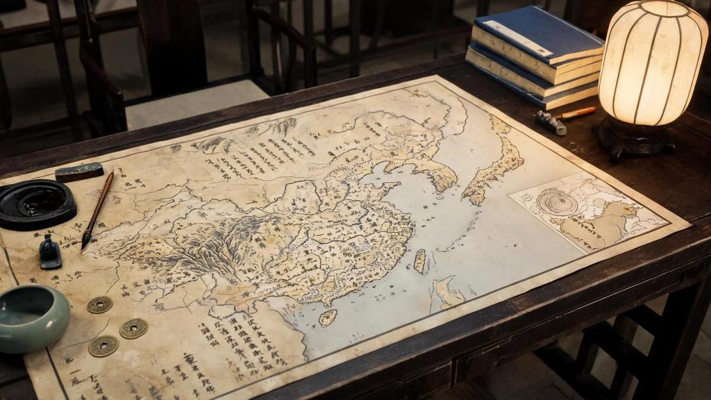
It survives in the last volume of the Wubei Zhi, the military encyclopedia Mao Yuanyi compiled from his family library in 1621. The chart was cut into twenty leaves, the equivalent of forty pages in a modern book. Laid end to end it runs about five meters, and it still rolls up small enough for a chest. Western scholars call it the Mao Kun map, after Mao Yuanyi’s grandfather, a former Fujian official whose collection it probably came from. In Chinese it is usually called the Zheng He navigation map.
It is the earliest and most complete set of Chinese sea charts still in existence, with about five hundred place names, more than three hundred of them outside China. The oldest printed European charts of the same kind, the two volumes Lucas Janszoon Waghenaer published in the 1580s, came a century later.
The Seven Voyages on One Chart
The map of Zheng He’s voyages above is a simplified reference version rather than a modern navigational chart. Each line represents one expedition, while the marked ports indicate the principal destinations recorded in Chinese sources. Viewed together, the routes show how the fleet’s operating range expanded over time: the first expeditions reached across the Bay of Bengal, later voyages extended toward the Persian Gulf and East Africa, and the final expedition followed many of the established routes once again.
Zheng He sailed seven times, first in 1405 and last returning in 1433, twenty-eight years in all. The size of Zheng He’s fleet is on the record. Ma Huan, an interpreter who sailed with him three times — interpreters were an official department, not hired hands, as we explain in our page on the Four Yi Guan — later wrote the Yingya Shenglan and noted what left port. Sixty-three treasure ships: the largest 44 zhang 4 chi long and 18 zhang wide, the middle-sized ones 37 zhang by 15. With them went 27,670 officers, banner soldiers, interpreters, purchasing agents and clerks, among them 180 physicians and medical assistants.
That largest figure works out to nearly 140 meters, longer than any famous wooden ship built later. I do not quite believe it. The best shipwrights of the early Ming still had timber, keels and watertight bulkheads to contend with, and a 140-meter wooden hull is hard enough to scarf together, let alone turn around in the Yangtze. Scholars still divide over the number, and I lean toward exaggeration without being sure.
Ports of Call, in Order
The seven voyages did not follow one identical route. Some expeditions stopped at different ports, while others revisited established diplomatic and commercial centers. This overview places the major destinations in sequence and shows how the fleet’s reach changed from one expedition to the next.
| Voyage | Years | Notable destinations |
|---|---|---|
| 1st | 1405–1407 | Champa, Java, Palembang, Malacca, Ceylon, Calicut |
| 2nd | 1407–1409 | Calicut, Ceylon, Siam |
| 3rd | 1409–1411 | Ceylon, Calicut, Malacca |
| 4th | 1413–1415 | Hormuz, Malacca, Bengal |
| 5th | 1417–1419 | Hormuz, Aden, Malindi |
| 6th | 1421–1422 | Southeast Asia, Calicut |
| 7th | 1431–1433 | Malacca, Calicut, Hormuz, East Africa |
Five meters of chart, five hundred place names
The chart keeps no consistent scale. Around Nanjing an inch covers about seven miles; along the African coast an inch covers more than two hundred. India is drawn as coastline only and stretched very long, and the Malay Peninsula loses its shape entirely. What the mapmaker cared about was the look of the shore, its islands, reefs and anchorages, and how many compass bearings and how much sailing time each leg took. East Africa is not placed in a lower corner. It runs to the left beneath India and Sri Lanka, so a reader has to picture Africa as a landmass south of Asia before anything on that page makes sense.
The Dutch scholar J.J.L. Duyvendak and the French scholar Paul Pelliot both argued that part of the chart came from Arab sailing records. The British scholar J.V.G. Mills went further, holding that it came out of an office attached to the fleet and was revised after each return, and dating the surviving version to about 1422, with other readings putting it between 1423 and 1430. The African stretch is drawn so differently from the pages before it that it looks like several charts of different origin stitched together.
How to Read the Zheng He Voyage Map
Two features stand out on any map of Zheng He’s voyages. First, the routes follow known monsoon corridors rather than crossing open ocean at random. The fleet sailed with the seasons, using changing wind patterns to travel westward and return eastward. That seasonal system helps explain why the voyages departed at particular times and why the routes often returned through the same major ports.
Second, the western reach of the later expeditions was much greater than that of the first. The fleet visited Hormuz in the Persian Gulf and reached East African ports such as Malindi. The surviving route records do not show the fleet rounding the Cape of Good Hope. They also do not provide evidence for treating the voyages as a circumnavigation of Africa; the chart is better understood as a record of the fleet’s documented Indian Ocean range.
The original chart was not intended to provide a geometrically accurate picture of the world. It was a practical sailing document that combined coastlines, place names, compass directions, sailing times, star measurements and notes about anchorages. Its value lies less in modern cartographic precision than in the information it preserved for sailors moving between known points.
At Malacca the fleet built a stockade
Zheng He’s fleet left the Yangtze, followed the coast south, and reached Champa first. Ma Huan’s directions run: from Wuhumen in Changle county, Fujian, southwest on a fair wind, ten days. Changle was the last anchorage before each of Zheng He’s voyages, where the fleet waited for the monsoon.
The real hinge lay on the western side of the Malay Peninsula. Ma Huan introduces Malacca by saying it hardly counted as a country: no king, only a headman, and forty taels of gold a year to Siam. Troops came when the gold did not. In 1409 Zheng He arrived with an imperial edict, gave the headman a silver seal and official robes, and set up a stone to mark the territory. Malacca became a kingdom, and Siam stopped sending troops.
What Zheng He’s fleet did there was more practical than the investiture. Ma Huan described the routine on arrival. A wooden stockade went up first, its walls pierced by four gates and watchtowers, and guards walked the walls with bells through the night. Inside it stood a second, smaller enclosure with the warehouses and granaries, where money and grain were stored. Ships sent to other countries came back here, counted and packed their goods, and waited for the south wind to turn in the middle of the fifth month, when the whole fleet sailed for home together.
Malacca therefore appears repeatedly in modern reconstructions of the seven voyages. It was not merely a port of call but a staging point between the South China Sea and the Indian Ocean. Its position helps explain why it appears in the route summaries for the first, third, fourth and seventh expeditions.
In 1431, before the seventh voyage, Zheng He raised a stele at the Tianfei temple in Liujiagang, near Taicang: more than eight hundred characters recording the dates, places and events of the first six voyages. That winter he raised another at Changle, over eleven hundred characters, much the same text. The Taicang stone disappeared and its wording survived only because a Ming collector copied it. The Changle stele is still standing, the only original left.
Past Malacca, across the Bay of Bengal
West of Malacca the route Zheng He’s ships took crosses the whole Bay of Bengal, past a place called Cuilan Yu, today Great Nicobar in India. On water that open, the compass gave direction and nothing else. To know how far north or south a ship had drifted, the crew looked at the stars.
Calicut was the end of that leg and the western gate of the whole route. Ma Huan calls it a great country of the Western Ocean, facing the sea. In 1407 Zheng He brought an imperial edict, granted its king a patent and a silver seal, and raised the ranks of his chiefs. The fleet built a pavilion there and set up a stone that read: ten thousand li and more from China, its people and goods alike in peace, the same customs everywhere; this stone is set here for ten thousand generations.
Calicut appears in the route summaries for nearly every major phase of the expeditions. It was a western gateway for the fleet, a place where diplomatic exchanges, commercial negotiations and the movement of goods came together. On the map, its position also marks the point where the route turned toward the Arabian Sea and, on later voyages, toward Hormuz, Aden and the East African coast.
Buying and selling at Calicut is described in detail. When Zheng He’s treasure ships arrived, the king’s headmen, the local merchants and the official brokers came aboard to fix a day for pricing. The silks and brocades were valued one by one and written into contracts, one copy for each side. The bargain was sealed when the headmen and merchants clasped hands with the eunuch commissioners and the broker named the date aloud, and the assembly clapped once. High or low, the price stood and was never reopened. Only then did gems, pearls and coral come out, and a single lot could take a month, sometimes two or three. Spices were the great money of this route: pepper from the Malabar coast, frankincense and ambergris from Arabia and East Africa, all passing east through these ports.
Northwest of Calicut runs the last leg on the chart, and it ends at Hormuz. Ma Huan’s sailing time is twenty-five days with a fair wind. Its wealth, he says, came from the merchants it drew, by sea and overland alike. Roast mutton, roast chicken and flatbread were sold in the market, and the shops held everything except wine, since the law executed anyone who drank. Ma Huan also recorded a trick of the local entertainers. A pole some ten feet long was set upright and a small white goat was led out. At a clap and a chant the goat climbed the pole section by section. The pole was raised to twice a man’s height, then the middle section was pulled away and a man caught the animal below.
West out of the gulf and into the Red Sea, the chart has another large port, Aden. In 1421 the fleet detached three treasure ships under a eunuch named Zhou, and they came back with gems, large pearls, coral two feet high, lions, giraffes and a striped animal the Chinese called the flower deer, most likely a zebra. Ma Huan described one local bird, the camel fowl, at length. Its body was flat and its neck as long as a crane’s. Its legs stood three or four feet tall, with only two toes on each foot. The feathers were like a camel’s, and it walked like one too. What the Chinese called a qilin was in fact a giraffe, and the name came from the local word for the animal.
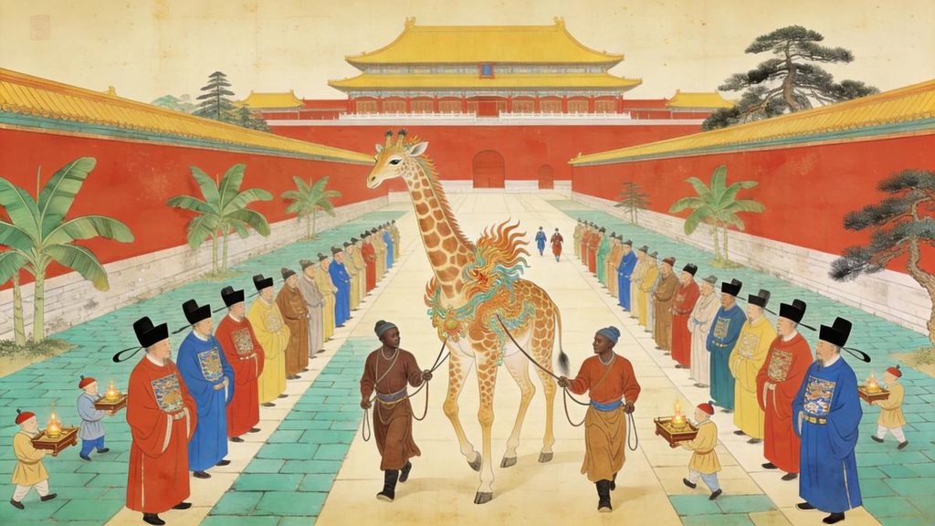
At Mogadishu the camels ate dried fish
Ma Huan’s book has nothing on the coast further south. Aden and Mecca were as far as he went, and the East African ports come from Fei Xin, who sailed in 1409, 1412, 1415 and 1430 and wrote the Xingcha Shenglan. The Somali and Kenyan coast has a page of its own in his book.
Mogadishu is the entry he wrote at greatest length. The town was built of stone on the shore, and its people drilled at arms and were rough in temper. The houses were stone too, four or five stories high, with kitchens, bedrooms and the room for guests all on the upper floors. The women coiled their hair and coated it with yellow lacquer, hung several strings of beads from each ear and wore silver rings at the neck. Outdoors they covered the head with a cloth and the face with black gauze, and they wore leather shoes. The land behind the town was wide and stony, yellow and red, with no grass or trees. Fields were thin and harvests small, and some years brought no rain at all, so water came up by windlass and went home in goatskins. The strangest line in the entry concerns the animals: camels, horses, cattle and sheep were all fed on dried fish.
South of it lay Barawa, where salt came out of shallow pools. A branch was thrown in, and when it was pulled out later it was thick with white salt, ready to eat. No fields were plowed there and the people fished, and the place produced the maha beast, the flower deer and rhinoceros, along with frankincense, myrrh and ambergris. Further south again was Jubba, a thin scatter of villages behind stone walls, no grass or trees, deep wells worked by windlass, and camel fowl six or seven feet tall. The order of these names on the chart is clear: Mogadishu, Barawa, Jubba, and furthest south Mombasa. The first three are Somali ports and the last lies on the Kenyan coast.
How far the fleet actually went is a question the chart and the books answer at two levels. The chart’s African stretch stops at Mombasa, and the two ports Fei Xin describes, Mogadishu and Barawa, were also named by Zheng He himself on the Changle stele in 1431. Beyond that it blurs. Mills argued that the place marked Malindi sits in the wrong position, to the right, or south, of Mombasa. It may in fact name a trading port further down the coast. Another reading holds that this part of the chart covers the Kenyan coast alone, and that the voyage ended at Malindi. On this view, what has been taken for Mombasa is really Faza on Pate Island. Both readings put the end of the route near the Kenyan coast, and neither can be proved. I lean to the second, for no better reason than that it does not require the mapmaker to have made an obvious ordering mistake. That is a weak reason, and new evidence can overturn it at any time.
The men who reached Mecca were not Zheng He’s own. On the last voyage, in 1430, Zheng He’s fleet detached a squadron at Calicut, met a ship bound for Tianfang, and the eunuch Hong Bao chose seven interpreters to go with it, carrying musk and porcelain. They came back a year later with giraffes, lions and ostriches, and a hand-painted picture of the holy city. Mecca was written in Chinese as Tianfang.
Twelve ebony boards and a lead weight
On open water the compass served by day and the stars by night, and the practice of measuring the stars had a name of its own, crossing the ocean by star. The instrument was a set of twelve ebony boards, the largest about 24 centimeters on a side and each of the rest smaller by steps, all of them marked with a number. There was also a small ivory square with a corner cut away, its four notches one quarter, one half, three quarters and one eighth the length of the smallest board, for reading the fractions. The navigator held a board out at arm’s length with one hand. With the other he pulled a cord about seventy centimeters long taut to his eye, set the lower edge of the board on the horizon and brought the upper edge up to the star. The number on the board was the measurement, counted in units called zhi, about 1.6 degrees each and divided into four parts. Where the North Star sat too low to see, Zheng He’s navigators measured a pair of neighboring stars in the same constellation instead.
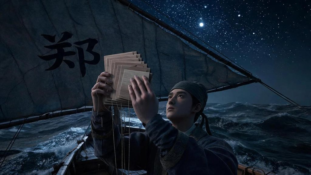
The Zheng He voyage map is not just a geographical representation; it also preserves specific star readings used for navigation. Four stellar diagrams at the end of it cover the two hardest crossings, Sumatra to Ceylon and Hormuz to Calicut. The Institute for the History of Natural Sciences in Beijing gives one complete example. Leaving Calicut, the North Star stood at six degrees twenty-four minutes; by Mangalore on the Indian coast it had risen to eight degrees; further out in the Arabian Sea it stood at ten; and at Dhofar, west by north, at twelve degrees forty-eight. Converted by the rules of the time, those figures match the real latitudes closely.
Dead reckoning had its own system. The Ming compass divided the circle into twenty-four bearings of fifteen degrees each, and between every two of them came a split bearing, so the instrument offered forty-eight directions of seven and a half degrees, finer than the thirty-two-point compass Europe later used. Every leg on the chart carries its bearing and its sailing time: a compass direction plus a number of watches. One watch was about a tenth of a day’s run, usually counted as sixty li. From Taicang to Hormuz the outbound route has fifty-six legs and the return fifty-three, and the two directions do not match exactly.
Near shore the last safeguard was the sounding line. A lead weight went down on a long cord, with a hollow in its base packed with tallow that would pick up a lump of the seabed. Depth was counted in tuo, roughly the span of a man’s outstretched arms, and the mud that came up told the crew how close they were to a harbor. A Ming route book gives the shape of it. Leaving Taicang harbor the ships held a bearing out of the river mouth, sounded six or seven zhang of water and found sand and mud, which was the right road; further along, off Tanshan, the water was seven or eight tuo deep.
Where the Zheng He voyage map’s place names are today
These ports appear on one chart because they belonged to a commercial system that had been running for centuries. Calicut collected goods on the Indian west coast, reaching east to Ceylon and the Bay of Bengal and west into the Arabian Sea. Hormuz joined the sea routes to the overland roads into Persia and Central Asia. Aden guarded the Red Sea, and the East African coast connected north to Arabia and south to the sources of ivory, ambergris and gold. Zheng He’s fleet followed routes others had already worn and called at these ports one by one.
Some of the names Zheng He’s pilots used have since changed. Samudra is northern Sumatra. The Maldives were the Liushan islands, eight atolls where, Fei Xin wrote, a ship driven in by wind never came out. Calicut is Kozhikode in India. Hormuz sits between the island and the mainland at the strait of the same name. The Portuguese took it in the sixteenth century, and its port later moved to Bandar Abbas on the coast. The Strait of Malacca is still one of the busiest waterways in the world.
Zheng He died on the way home in 1433. The fleet returned, and there was never an eighth voyage. Some fifty years later, in the Chenghua reign, a eunuch raised the idea of sending ships west again. The emperor ordered the Ministry of War to produce the old records. Yan Congjian, a Ming official, recorded what happened next. Liu Daxia, a bureau director in the ministry, had the files hidden first. When the minister Xiang Zhong sent men into the archive for three days, they found nothing. Liu then spoke his mind. “The voyages of the eunuch Sanbao to the Western Ocean cost several hundred thousand in money and grain,” he said, “and the soldiers and commoners who died ran to tens of thousands. If the ships came back with rare goods, what good did that do the state? This was a ruinous policy, and ministers ought to have spoken against it. Even if the old files still existed, they should be destroyed to pull the matter out by the roots. Why inquire whether they were there or not?” Xiang Zhong rose from his seat and told him his hidden virtue was no small thing, and that the post would be his before long.
The story changed shape afterward. Gu Qiyuan, writing a little later than Yan Congjian, turned the hiding into burning, and that version became the common one. Scholars in the twentieth century went through it point by point. Shi Cunlong, formerly of the Ministry of Transport’s institute for water transport research, wrote a long article listing the doubts. Ming books disagree about Liu Daxia’s actual post in the ministry. The early sources say only that he hid the files and spoke angrily, with the burning added later. The archives of a fleet of twenty or thirty thousand people were not a few notebooks that could be tucked away. And the History of the Ming, compiled under the Qing, never adopted the story. He concluded that the charge should be dropped.
The year the records went, and the hands they passed through, will probably never be settled. What is certain is that the Ming lost its own full account of twenty-eight years at sea, and that the Zheng He navigation map survived only because it was folded into a military encyclopedia. The routes and ports it drew were carried on by others. In 1498 Vasco da Gama rounded the Cape of Good Hope and landed at Calicut, ninety years after Zheng He first reached it. The harbor he sailed into had been named on the chart for a long time.
Questions readers ask
Q:What is the Zheng He navigation map?
A:The Zheng He navigation map is the set of charts that survives in the last volume of the Wubei Zhi, a Ming military encyclopedia compiled in 1621. It begins at the Treasure Shipyard in Nanjing, ends at Hormuz in the Persian Gulf, and names about five hundred places along the way. Modern Chinese sources call it Zheng He’s Navigation Map.
Q:Is the Mao Kun map the same thing?
A:Yes. Western scholars named it after Mao Kun, a sixteenth-century official and collector whose library probably supplied the charts to his grandson Mao Yuanyi, the compiler of the Wubei Zhi. The two names describe the same document.
Q:How far did Zheng He’s fleet go?
A:The chart’s African stretch ends at Mombasa. Fei Xin, who sailed with the fleet, described Mogadishu, Barawa and Jubba, and Zheng He named the first two on a stele in 1431. Most scholars place the southern limit on the East African coast at or just south of the equator. There is no evidence that the fleet rounded the Cape of Good Hope.
Q:Did Liu Daxia burn the fleet’s records?
A:The earliest account, in the Shuyu Zhouzi Lu, says he hid them and said they deserved to be destroyed. A later writer turned that into burning. Shi Cunlong argued in 2010 that the charge should be dropped, and the History of the Ming never carried it. The question is open.
Q:Was the chart accurate?
A:As a map of the world, no. Its scale swings from about seven miles to the inch near Nanjing to more than two hundred along Africa, and it omits everything inland. As a sailing document it was precise: bearings, watches and star readings that, converted into latitude, come close to the real positions of the ports it names.
Sources and further reading
- Mao Kun map / Zheng He’s Navigation Map, English Wikipedia: https://en.wikipedia.org/wiki/Mao_Kun_map
- Ming treasure voyages, English Wikipedia: https://en.wikipedia.org/wiki/Ming_treasure_voyages
- Zheng He, Encyclopaedia Britannica: https://www.britannica.com/biography/Zheng-He
- Ma Huan, Yingya Shenglan (Overall Survey of the Ocean’s Shores), Chinese Wikisource, entries on Malacca, Calicut, Hormuz, Aden and Mecca: https://zh.wikisource.org/wiki/瀛涯胜览
- Fei Xin, Xingcha Shenglan, Chinese Wikisource, entries on Jubba, Mogadishu, Barawa and the Maldives: https://zh.wikisource.org/wiki/星槎胜览/卷2
- Mao Yuanyi, Wubei Zhi, chapter 240, Library of Congress copy with the full chart in 22 images: https://www.loc.gov/item/2004633695/
- Institute for the History of Natural Sciences, Chinese Academy of Sciences, on star boards, the 24-point compass, compass routes and sounding: https://ihns.cas.cn/kxcb_/kxjd/202212/t20221206_6567192.html
- Guangming Daily, on the Liujiagang and Changle steles: https://news.gmw.cn/2017-06/04/content_24687320.htm
- Shi Cunlong, “Who stole and burned the Zheng He archives?”, Culture Magazine (Macau), 2010
- J.V.G. Mills, Ma Huan: Ying-yai sheng-lan (Cambridge, 1970); J.J.L. Duyvendak, “The True Dates of the Chinese Maritime Expeditions”; P. Pelliot, “Les grands voyages maritimes chinois au début du XVe siècle”